Mexico Calling
An edited version of this article appeared in the The Shaft, newsletter of the Washington State BMW Riders, in May and June 2007.
I spent February 2007 on the road, riding from Seattle deep into Mexico and back again. Along the way I collected over a thousand photos, five hundred waypoints, and several hours of voice memos. This article tells part of that story.
Seattle
I wake up at 03:00 and open my eyes and realize that my dog is one inch away, breathing on me. She wants to be let out into the back yard. Probably there's a possum or a coon out there. I get up and let her out, and go back to bed, but I can't go to sleep because I know that this is the morning I head to Mexico. After a few minutes I realize that I'm going to be getting up and leaving now. I spend that few minutes savoring the last time that I'll sleep with my wife for a while. Then I get up, make final preparations, and hit the road.
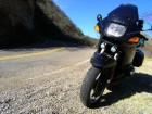
(Final preparations become routine for the next month. Check the bike, a 1996 R1100RS with a few farkles; make sure it still has wheels & etc. Then plug in and turn on the GPS, a Garmin eTrex, small but adequate for Mexico, where decent GPS maps are not yet available. Then zip on the tank bag, bungee on the duffle, jack in my electric vest, don my two-piece Aerostich suit, put in my earplug/headphones, put on my full face helmet, and finally my gloves. Ready for ignition.)
At 04:25 I'm on the move. Its frosty, and the nearly full moon still casts plenty of light. I'm glad of the light cast by the new PIAA driving lamps. I'm wearing nearly all the clothing I bought on this trip - two polypro t-shirts and poly/wool longjohns under heavy jeans and cotton shirt, with a face fairing to keep my neck warm. I'm still cold but the highway is nearly empty, and fast.
Hidalgo Del Parral
I am writing on an ancient (20th Century) computer in the lobby of the Hotel Acosta in Hidalgo del Parral, Chihuahua. The trip has been going pretty smoothly, not quite as planned but not bad. February 3 was a freezing blast down I-5 to redwood country, where friends fed me and beered me and warmed me and we talked science and that was great. Up at the crack of dawn on the next day, another cold one through valley fogs and over frosty twisty roads to north of San Fran, where I gave a little workshop on forest ecology to some people whose land trust owns a redwood grove near the Muir Woods. Then, just as the Super Bowl was starting, I blasted off across the Bay area on I-580 for a fast and boring run that burned me out around sunset on I-5, where I got off and followed a lean empty two-lane across the Valley to CA-99, and then south another hundred miles or so to finally call it quits in a field northwest of Visalia, where I crashed for the night under a clear cold starry sky.
I set forth the next morning - still cold, wearing every stitch I brought - at 0430, through Bakerfield to Mohave to Barstow, then off on old Route 66 - shades of Cars (the movie), desolate little ghost towns in the stark desert, and along the way I found the Baghdad Cafe - I guess the Hollywood crowd like to cruise old 66. From there I went on even emptier 2-lanes, hours without seeing a car, until eventually down to cross the Colorado at Parker, Arizona where it was finally WARM. Spent that night in a little campground north of Gila Bend, under a million stars, only to rise and again hit the road well before dawn and blast through Casa Grande and Tucson to cross the border (not even a stop sign for those entering Mexico) at Nogales.
Nogales is a short sharp shock of Mexican traffic. It's two years since I've been in country and it takes a few minutes to recall the distinctive style of Mexican driving, but then I'm weaving around trucks and buses and paying scant attention to traffic lights as well as the rest of the crowd, and so I manage to move with the flow and in a few minutes I'm out of town.
Twenty kilometers (now that I'm in Mexico I'll be on the metric system) south of Nogales is a station where gringo motorists go through the vehicle entry process, which involves getting things stamped and copied and certified, standing in lines - bureaucracy, in a word - but it didn't take long. Maybe I was there for an hour. After getting stamped and copied, I got all packed up ready to go, and the bike didn't start. I looked down to see a rapidly growing pool of gasoline washing up against my boots. So I shut everything off, unpacked the tools, and pulled off the left fairing cover to find that the left fuel injector hose had somehow come unclipped while sitting there in the sun. I reattached it, put everything back together and I was on my way.
The highway south from Nogales to Hermosillo was not what you'd call scenic. There are some big barren rocky mountains in the distance, kind of like in southwest Arizona, but the area around the highway - which is mostly a cuota, Mexican for toll road, costing 89 pesos (11 pesos to the dollar, by the way) - is flat and covered with thorn scrub. There was one small area of saguaros near a town called Saguaro. Riding through the Sonoran desert near Tucson and from Tucson down to Nogales, in contrast, had a lot of saguaros and more cactus diversity in general and more vegetation diversity overall. The Arizona landscape seems to have been a bit less hammered by cows and other human influences, notwithstanding the road does pass a huge strip mine and some massive housing developments.
Hermosillo, on the other hand, is a pleasant enough town. Like almost every town in Mexico, it has a town square or two, also called a plaza or zocalo, which is the center of town - lots more pleasant than a bank. The plaza always has a church and some sort of garden, and it usually is also the place to find interesting restaurants and hotels. It's also the place to hang out. In Hermosillo, that mostly means old guys in cowboy clothes, sleeping in the sun. My hotel in Hermosillo, the San Andres Hotel, 420 pesos, is about a block from the plaza. It has comfortable beds, and a secure place to put the bike, and that's enough for me.
Hit the road early the next morning, the road being Mex-16. For 130 km nothing happens except fast riding on a straight road with a few sweepers, through the chill clear morning. Then it hits the Sierra Madre and the next 350 km is twisty, beat-up Mexican highway to the max, endless hairpin curves replete with giant potholes, loose gravel, big trucks, wandering cattle, and the occasional rig broken down in a blind curve. It took two days to get through. The first part was lazy, which was good because I needed some time to wake up. At km 72 out of Hermosillo is a little village called San Felipe, where you can get groceries but not gas. A stream there had water in it, the first I've seen since crossing the Colorado River. Then came the village of Tecoripa at km 119, where I stopped off at a little grocery for some faux orange juice and pan dulce, and waved at some kids in the town square. That was breakfast. Cost 10 pesos.
At about km 130 the road becomes exceedingly twisty, mostly third and fourth gear curves, sometimes down to second, always either climbing or descending through the the Sierra Madre. Mostly there was no other traffic. I'd see a car, or more likely a truck or bus, maybe every 15 minutes.
The highway crosses the Rio Yaqui at km 165. The Yaqui is a serious river, bigger than the Colorado and flowing fast. There's a spot there to pull off and ride down by the water. I saw cormorants, great blue herons, flycatchers, shorebirds, and a tiny bright red bird. I wonder what the hell it was. There was no settlement; apart from the highway, it felt like wilderness.
After about 200 km the road enters the pine forest. I crossed the mountain crest at an elevation just under 2000 m and there was snow along the sides of the road, and some bits of ice on the road. It was slow going. The road is really twisty, and a lot has pretty bad pavement and a lot has gravel on it, washed on by streams or laid down by trucks in the icy bits.
I camped where Mex-16 crosses a ravine and a little stream, about 50 km west of the Sonora-Chihuahua border. The stream looks clean and is cold, coming down out of the pine forests. Little fish were jumping for bugs in the twilight. I think the place was originally built as a rest area because it had a transportation department trash barrel, but as with most Mexican infrastructure it was left to maintain itself. Occasional passing trucks made great roaring noises with their Jacobs brakes. I was well off the road and not visible from the highway, so it made a pretty secure campsite. Just downstream, the stream descended into the northern part of the Barranca del Cobre area. The highway offers great views south into the barrancas. The stream itself is lined by a forest of oak and cypress with an occasional pine and some junipers.
I hit the road this morning when it was still dark but getting light in the east. I immediately noticed that my speedometer was not working. I think it broke on the bumpy descent and stream ford to get to last night's camp. Oh well, it's hardly critical. Good thing, too; the last BMW dealer was in Hermosillo, and there are only six in the whole country. No matter. The highways have km markers, and the GPS tells me my speed and lets me pick waypoints.
At about 350 km from Hermosillo the road crosses a pass and enters Chihuahua. Road quality immediately improves - it has lines, sometimes guard rails, and is a bit faster but still plenty twisty. This really is a world-class motorcycle road overall. Beyond it climbs to over 2250 meters. The way is very twisty and gravelly in places because of gravel that has been spread for the ice. At one point there is ice all the way across the road, in a very shady area, and here I found white pines.
The highest point on the whole highway is reached at a pass overlooking the plains of Chihuahua. Starting about 20 km before that point the road starts to straighten out, and there are some long sweepers. After that, it's goodbye to the twisties and there's a long straight run down into the grassland and the plains of Chihuahua, the very, very, wide open spaces of Chihuahua. From there I quickly rolled off the 300 km to here, Hidalgo de Parral, a small, historic bustling city in the desert. Tomorrow ... Durango!
Durango
At 8:00 or so I finally rolled the Beemer out of the lobby of the hotel and rolled off the 400-odd kilometers to Durango. It was mostly a very unremarkable road. One stretch did not have a curve for over a hundred kilometers, though other bits had some very good curves. Along the banks of a river that runs, among other things, through the town of Rodeo, there was a magnificent stand of baldcypress. A lot of trees were over 7 feet in diameter.
The city of Durango is said to have about a half million people. It's small enough that I didn't have any problem finding my hotel, the Hotel Roma, about a block off the main plaza. As for the traffic, well, I'm getting pretty blasé about Mexican traffic.
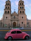
When I got to the hotel, they carved out a parking place for me right outside the front door, fitting into a narrow space between two parked VW Beetle taxis; I had to remove the saddlebags to get in. Actually the Beemer ended up spending the night locked inside a nearby garage. In the evening I strolled around the square and the market district. It's a very clean, popular square. Old men in cowboy hats talking or just sitting, families with ice creams, young couples strolling. I should have taken more photos but I always feel self-conscious taking pictures of people. Maybe its because I'm the only gringo I've seen the whole trip, so far. There was one picture I wish I could have gotten. About 20 people were waiting for a bus, and they were all standing, one by one, against an old stone wall of the cathedral. They represented a perfect cross-section of Durango society, from fashionable young women to grimy urchins to old cowboys to men in suits. Durango is an old city with lots of character, far nicer than Hermosillo. My hotel is very pleasant - an historic old building with tiled bathrooms and comfortable beds, tall ceilings, old furniture, interesting architecture, and all for the princely sum of $21 a night. However, I will be happy to leave tomorrow because the journey toward Mazatlan should be one of the best stages of the whole trip, both botanically and from a motorcycling standpoint.
San Blas
I was soon to find that much of the state of Durango has dramatic, if austere, landscapes - mountains rising skyward in huge broken planes of yellow and red volcanic rock, only a few cacti and scraggly bushes clinging to the precipices, and atop - sometimes - extensive forests of towering pines. Leaving the old city at dawn the next morning I rode upward to El Salto, a classic logging town of sawmills and bars, where the smells of resin and sawdust pour out of a dozen mills. The highway was cluttered with log trucks hauling pretty big timber, comparable to the usual Northwest second growth, and a rusty Heisler locomotive welcomes visitors at the town's entrance. The forests are managed well here - selective cutting, carefully done - though a total fire exclusion policy will lead to troubles if it works for more than a few decades, as it has in our country.
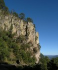
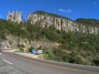
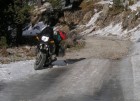
At about km 150 the road transforms from a line of sweepers and straightaways across a high forested plateau, to extreme twisties in a rough and jagged mountain range. Here began what I think is probably the finest motorcycle road I have ever ridden. The road winds along the summit ridges of spectacular mountains, sheer cliffs to both sides, and as one crosses the range toward the Pacific the vegetation changes from dry pine forest to fir forest, pines and oaks cloaked in epiphytes, then weird tropical pines like Lumholtz pine with long needles all hanging lax and limp. The most spectacular section crosses La Espinoza del Diablo - the Devil's Backbone. This is a knife-edge of stone along the mountain crest, with spectacular overlooks down canyons thousands of feet deep on both sides. The governments of Sinaloa and Durango are very proud even to have built this road - it would be seen as an engineering feat by anyone - and the fact that it so twisty (50 kph is a blistering speed) only makes it more fun.
Darkness caught me a few kilometers farther. I found a logging road just past a small village and went up it about a kilometer, and then went up a washed-out spur that trucks couldn't get up but motorcycles can, and drove down that to a peaceful spot in a forest of oaks and pines. The oaks were full of bromeliads and there were even a couple on the pines. I cooked a simple meal and slept well.
Morning, again, I was up and on the road by sunrise. It took me three hours to ride the twisty 6700 foot descent to the Pacific coastal plain near Mazatlan. It was an idyllic ride. Being early on Sunday morning, there was almost no traffic. The sun was behind me, strange tropical vegetation lined the road, and ahead were ever-widening vistas out toward the Pacific. In the last part of the descent I passed a variety of bikers. At one point I passed a group of 10 or 12 small Mexican street bikes (meaning the largest were probably 250cc), and then a bit later I passed a comparable group on big bikes that included new-looking large-displacement Japanese bikes, an R1200RT, and a couple of cruisers. I think they were Mexicans as well, a group of upper middle class Mazatlan guys out for a Sunday morning ride. That was to be the only time in Mexico that I saw what I would call sport riders. The twisties started to fade out at about km 155 (counting down into Mazatlan now), but turn into high-speed sweepers, 4th and 5th gear, that'll take you down to Concordia at which point you're pretty much in the flats and the curves disappear. I go past Concordia to the junction with Mex-15 (the free road, not the cuota).
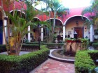
After reaching the flatlands, the glamor pretty well went out of the ride. I followed Mex-15 south for a couple hundred kilometers, and then took a small winding rural highway out to the coast and the town of San Blas. Here I finally found a population of gringos. San Blas used to be known as a good place to get malaria, which means today that it's a good place for ecotourism - the coastal swamps there are home to an incredible diversity of birds, plants and fishes, along with certain exotica such as the 'crocodilas' which, if a bit small for crocodiles, are still pretty exotic critters to see hanging out on the riverbank. I'm staying at the Hotel Hacienda Flamingos, the fanciest place I've found in Mexico. It costs about $70 a night, but what a hotel - all the modern conveniences in a beautifully restored hacienda with thick oak doors, tiled hallways, and a lovely courtyard with palms and a fountain. San Blas has gringos (all of them Canadians, as far as I can tell), so I can go out to restaurants and meet people who speak passable English and have interesting tales to tell about their Mexican travels while we eat great food, drink margaritas and otherwise do the usual stuff that most people do on their Mexico vacations.
This is my second day in San Blas. This morning I was again out riding at the crack of dawn, taking a little time to visit nearby Mexcaltitan, the legendary origin-place of the Aztecs. A long time ago in the Whole Earth Catalog I saw an aerial photo of Mexcaltitan taken by Georg Gerster. At that time I thought it was the most amazing, exotic-looking place I'd ever seen, and I would dearly love to come here. I put it on my list of things to do later on. Now its 27 years later on and I was thinking as I rode out there, that it didn't carry nearly the significance that it would have in 1980, and that seems to mark how my priorities have changed over time. I was thinking that I'd rather be doing something with a wife or a close friend, for instance, rather than being in this exotic place and going alone to see a town that once looked really nice in a picture. Having been there now, all I can say is that it's a nice enough little town, not much happening there, it's just a bit unusual in that you need a boat to get there, and the streets are all built like canals because during the rainy season the water comes up 5 feet and you need a boat to get around in town. This is the dry season, though, so the canals are all dry and sandy (and the mosquitoes are absent).
The trip back from Mexcaltitan was uneventful. I was irresponsible and rode without a jacket, because it was pretty hot and humid. I left the bike at the hotel and went to a place called McDonald's - no golden arches - where I had lunch and chatted up another gringo, a guy about my age, who was nearly at the end of his tour. He'd mostly done the Barranca del Cobre and San Blas. Now I'm at the local beach, Playa Borrego. This is what most gringos come to Mexico for. There seem to be a fair number of them here. There are mountains and palm trees and a vast expanse of beach backed by cabañas that serve mariscos (seafood) and cervesa (beer), with a few mostly elderly gringos sitting around absorbing photons. Anyway, no paucity of gringos in San Blas. I just don't get it. It's kind of nice, I'll take a picture or two, but there's not really anything to do here except drink and eat, sit in the sand, talk.
Patzcuaro
I got out of San Blas early in the morning and followed the coast highway down through Puerto Vallarta, which was my least favorite place in the entire country. It reminds me of Las Vegas, with tour ships instead of casinos. Dozens of American chain stores are there (and nowhere else), the streets are thronged with Americans, the prices are in dollars. It took two hours to get through. About 20 km south, though, I had a wonderful few hours at the Puerto Vallarta Botanical Garden, a new institution set in a wonderful dry tropical forest, the trees hung with lianas and filled with bromeliads, exotic colorful birds flitting through the forest, and a clear cool stream babbling through a rocky canyon. The garden itself is particularly strong on orchids and bromeliads. South of there I saw Jalisco pine, a very rare species, and celebrated the discovery with a cold cervesa in the cantina at the foot of the largest pine I found. Noodling on down the line, night finally caught me at the little seaside village of Tenacatita.
Tenacatita was the first and almost the only place on the trip that I had seen before. When I came here in 2005, we visited Tenacatita and snorkeled the reef there. So, I knew about a perfect little out-of-the-way camping area full of gringos on a little tombolo where you can see the sun set into the Pacific Ocean - and then see it rise out of the Pacific Ocean the next morning. After a dinner of ceviche and cervesa I did just that, and under the warm tropical sky, sleeping out on the beach, I also got to see the Southern Cross rise, a couple of hours before sunrise.
The next day was, in a word, halcyon. I took breakfast just down the line in Barra Navidad, where I shared huevos rancheros with a couple of Canadian bikers - from Vancouver - the first gringos on bikes that I met all trip. One was on an R90/6, the other on a 1974 Yamaha 250 enduro. He said he had 90 pounds on that little bike besides himself and he could still do 65 on the freeway. Later in the day, winding through a small city farther south, I met another Canadian - this one on a Kawasaki KLR650, bound for Chiapas - and he was the last gringo biker I met, though in fact I also saw him one more time, farther down the coast. Otherwise, the day was spent riding the winding, nearly empty coast highway, eventually spending the night at a tiny village in Michoacán, where I had another dinner of cervesa and ceviche, watched the sun set and the Southern Cross rise, and slept on the empty beach with the sound of crashing surf.
There's another thing. This is the first day on which I really feel that I'm just traveling by motorcycle through Mexico. All of the separation anxiety, acclimation to the new experience, worries about the language and the equipment, how to pack, how to spend the day, what pace to travel, and all the other niggling details, have all dropped away. This morning, riding a very twisty and totally deserted Mex-200 on the coast of Michoacán, I was just riding Mexico. I feel as if I could go on this way for months. It's taken almost two weeks, but I'm finally shuck of Seattle and work, and I'm back in the bush—all of me.
Today was my last taste of riding the Mexican seacoast. Some of it was pretty rough road, but most was good, smooth and clean, and pretty twisty - generally third gear. I also passed my southernmost point on this trip, following down the coast to Lazaro Cardenas near the Michoacán-Guerrero border and then turning north on Mex-37 towards Patzcuaro. Not without a sense of regret. The seacoast is a beautiful area, the most inviting part of Mexico I've seen. But, I came on this trip mostly to pursue some botanical goals, and lately I haven't been spending too much time on that, so I guess it's time to head out and find some more trees.
Today, after I bade farewell to the slothful coast and turned inland, I rode fast toll roads and twisty mountain highways to the old mountain town of Patzcuaro. In the process I gained 2000 meters of elevation and made a shocking discovery - it was February! My ride from Mazatlan down the coast had been warm, even hot, the nights balmy - but Patzcuaro is on the Central Volcanic Plateau, and it's a chilly place. It's a colorful place, though, filled with narrow streets, classic Mexican architecture, shops selling native handicrafts, good restaurants. I'm spending the night at the Hotel San Gabriel, where for the princely sum of 200 pesos I get a quiet, spacious, clean but well-worn room, and the bike gets a nice secure courtyard outside my window.
Cerro Peña Nevada
Riding out of Patzcuaro was bloody cold. A heavy frost covered the fields and reached out across the road, and I was wearing all the clothes I brought for what proved to be a very long and uneventful day's ride across central Mexico. At the end of it, though, I made it to the mountains of Guanajuato. Following another incredibly twisty mountain road high into the mountains, I made it to the little village of San Joaquin, and here encountered the rare Gregg's pine. This tree is first cousin to a group of pines that otherwise live only in California - the knobcone, Bishop and Monterey pines. How and when it got to Guanajuato is a mystery of biogeography. Here I also saw the only ruin of the trip, Ranas, a mountaintop city inhabited from A.D. 600 to 1200. The mountaintop in question straddles the Divide, and warm moist ar from the Gulf of Mexico rises on the east side to shroud the peaks in fog much of the time, while cold dry air from the central plateau keeps the western side of the mountains in desert. The ancient city sits on the borderline, and as I sat there, the cold mists swirled around me while the sun shown bright in a cloudless sky. The sun was lowering in that sky, though, so I beat a retreat down the long twisty road to spend the night as the only guest in a tiny trucker's hotel, in a little village at the foot of the winding road.
The next day started with what might be the second best motorcycle road I've ever ridden. The first fifty kilometers was a winding decent into and climb out of a desert canyon. Weird columnar cacti and giant agaves cloaked the mountain slopes, and at long intervals the road passed through a tiny village where goat herders and irrigation farmers eked out a living. Then the road started to climb, first into the piñon-juniper woodlands and then into a full continuous pine forest. Here again I noticed something that also stuck me the day before, which is that while the desert valleys are almost empty, the forests are filled with people. The increased rainfall at higher elevations, coupled with the sustenance opportunities of timber and piñon nut harvest, make the high mountains a relatively benign and desirable environment, and so not only the ancients but also the poor people of today site their villages on the bounteous summits. At 3000 m elevation this road crossed to the east side, and though the day was clear and bright, the roads were wet from the night fog, and water still dripped from the trees. On this side the mountains were thickly forested, streams cascaded down the mountainsides, and springs burst forth here and there. At one spring, on a steep mountainside, I found an ancient gnarled baldcypress close to 10 feet in diameter. In the valley bottom, a clear river ran through prosperous villages, its banks lined also with baldcypress.
Climbing out of that valley, the road again turned inland, and within a span of 50 km I was in a desert again, surrounded by dry shrubs and tall cacti. The rest of the day I simply rode fast and hard into the north, bound for the tall mountains of Nuevo León. I made it as far as Matehuala, a nice enough town but I was dead beat, and only had a dinner (where 75 pesos got me a steak a foot across) and a shower before going to sleep in a my room at the spare but pleasant Hotel Alamo, half a block from the plaza.
This morning I rode fast, east into the rising sun, to the town of Doctor Arroyo near the sounthern tip of Nuevo León. A little ways out of town I found the turnoff for San Miguel de Peña Nevada, and shortly afterward left the pavement behind and began the long climb, on an endlessly twisting and turning sand and gravel road, into the mountain range, the Cerro Peña Nevada. This time, both the mountains and the desert were nearly empty of people. I started seeing the trees, though, as soon as I left the bajada and started onto the mountain proper. There was a remarkable array of conifers, including a number of rare and remarkable species I had never seen before, such as Nelson's piñon, the Johannis piñon, Vejar fir and the Mexican yew.
The road was not bad, at first. Then it was bad. It was a track blasted out of the limestone bedrock, with a few blasted chunks thrown back on to sort of level it out. The bike chuffed and backfired and now and then a smell of burning clutch scented the piney woods, but we still climbed upwards (I never got out of first gear for nearly two days) to finally crest the Sierra at nearly 3000 m elevation. Snow carpeted the north slopes, and alpine pines lined the road. I was really out there. I rarely saw another vehicle and when I did it was a local who looked at me as if I'd just gotten out of a flying saucer. On that high divide, I really felt as if I'd ridden to the end of the earth. To do a road like that on a heavily loaded R1100RS is a bit of an adventure in its own right. I rather doubt anybody else has ever taken an RS over that road.
I should emphasize that throughout this adventure I knew exactly where I was. After all, I had a GPS. However, I had nothng even vaguely resembling a map. The whole of the Sierra Peña Nevada is a blank space on the best map I have. So I noted the locations of any road junctions I passed (there weren't many), and I watched my back trail, and I watched the gas gauge slowly sink. It all worked out. After I passed the crest, the road improved a little (a very little) and I encountered some tire tracks. Then a tiny village. Then a microwave tower. By this time the sun was setting, so I headed down something that had once maybe been a road, found a spot with a wonderful view over the valley to the east, and made camp. Here I sit. The mountains across the valley are red in the sunset, I have a dinner of water and peanuts, and my camp will catch the rising sun's rays. All is well with this world.
Nuevo Casas Grandes
I woke up at 4:30. Its not that I wasn't sleepy. It was a truck grumbling up the road. If there is one sound that will always remind me of Mexico, it is that of an unmuffled diesel. They are ubiquitous. In this case, it was in a logging truck, going to work at the same time logging truck drivers everywhere go to work, on a Monday morning. The next logging truck came by - moving about 5 kph on this very steep road, so it takes 10 minutes for one to pass - 15 minutes later. And the next, in another 15 minutes. I put in my earplugs and listened to Beethoven until first light, and then I packed camp and hit the road.
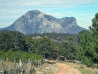
It only took 3 hours to get back to a paved road. It was a very small one, but it led to a larger one, and pretty soon I was rolling down the highway again. There were a lot of straight stretches but also some good sweepers, mostly 4th and 5th gear stuff, through scenery of mountains clad in piñon forests and valleys filled with pastures, with an occasional village. In time the highway led to a town called Galeana, in the shadow of Nuevo León's greatest peak, the Cerro Potosí. Potosí is a mammoth hulk of a mountain, rising from Galeana at 1500 m to a summit at over 3700 m, and standing alone and apart from every other mountain range. It is solid limestone, and it has a hell of an interesting flora, and on top grows one pine that grows nowhere else, and another that only grows in the far-off Rocky Mountains. So at 12:30 I started up Potosí, in first gear again, but this time on a paved road. It was made of a pavement of placed rocks, sort of like what they use to pave village streets but instead of rounded cobbles in neat rows, this road was a mostly random jumble of sharp angular cobbles. In places, fines filled the interstices to provide a reasonably level driving surface, but elsewhere water had eroded away all the fines leaving a road of highly angular big rocks. My tires survived it, but they are definitely looking pretty beat after close to 4000 miles of Mexico. It was a very warm day. I took off my suit and my helmet and I just bounced up the road. I figured things can't go too far wrong riding absolutely at the lower limit of first gear, 1200 rpm. Meanwhile the scenery was gorgeous, with vast views reaching out at least 100 km, and lovely pine forests all the way.
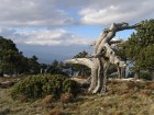
At 5:00 I finally bumped to a stop a few yards below the summit, where a drift of snow blocked the road, and I walked on to the top. Gnarled and stunted pines grew up there, and jays flitted about scavenging nuts from them. One of them, Potosí pine, grows only there - nowhere else. It's the shortest pine in the world, never more than 10 feet tall. On the summit it forms mats 50 feet across, and it grows all over the place. The summit has a microwave station and a giant golf ball, about 50 feet tall. Don't know who owns the golf ball but it looked sort of military, probably has some fancy antenna on the inside.
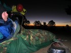
After awhile I started down again, but not too far, making camp at a fine spot at 3400 m, by far the highest campsite of the trip. At my arrival in camp, I was bushed. I have never ridden such strenuous roads in my life. Wrestling the R1100RS up and down that mountain qualifies as an epic, if anything on this trip does. Anyway I set up camp, snuggled down ino my sleeping bag, started brewing cups of hot tea, and watched the sunset steal over the land until the ridge crest of Potosí was the only thing illuminated for as far as the eye could see. Then I slept.
It was, of course, a cold night and a frosty dawn. Fortunately the campsite caught the morning light. I spent a couple of hours up there, doing botany-ecology stuff, and then came the long bumpy ride down the hill. From Galeana I rode into the hills again, just for a couple of hours, until I found one last species on my list - the northern variety of Gregg's pine - and then it was done.
No more trees to see. No more mountains to cross. No more surf to lull me to sleep. Only a thousand miles of craggy Mexican blacktop between me and Douglas, Arizona - time to ride.
So I rode. I rode 400 km in what remained on the day, blasting 150 kph across the vast empty plain between Saltillo and Torreón racing the setting sun, reaching Torreón just as full dark fell. Damnéd Torreón. Torreón of the stinking chemical fctories, freeways, chain stores. Riding through nighttime rush hour frenzy on highways under construction, maps useless, GPS useless, I finally spotted a MOTEL sign. It turned out to be a sex motel, where each room has its own garage so people won't spot your car and know that you're in a sex motel with your mistress. Where TV carries the Playboy channel and room service carries nothing but hard drinks. I don't care, it got me off the dark crazy highway. I checked in and slept.
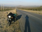
At 6:00 I'm awake and bored so I leave. It is still totally dark but there's no traffic so I wander around for half an hour and finally find the highway to Chihuahua. I ride and ride and ride, vast empty desert spaces on high speed highways. 800 km later I reach Nuevo Casas Grandes, 200 km from the border, and I stop. Here I am. Time to go find dinner.
Gila Bend
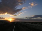
That's sunset. The sun just disappeared behind the mountain ridge.
I am out here 10 miles or so north of Gila Bend, Arizona. I was scanning the roadside industriously for the last 30 miles or so because we're in saguaro country still, and I haven't camped out among the saguaros for many years. I thought it would be nice to find a totally isolated place out there with the saguaros and the desert stars for what might be my last night in the bush this trip. I'm a pretty good distance from Tucson and Phoenix, with a mountain range or two between me and them, so I should see some decent stars. By some old abandoned houses on the east side of the road, I spotted a dirt road winding off toward the Maricopa Mountains, and I followed it. That led me to another dirt road, which led me to a powerline corridor, and finally a turnoff led me here to near the base of the mountains, a campsite where spent cartridges litter the desert floor. I don't reckon anyone's been here since last weekend at least, and probably won't be until next, so I've got the place to myself.
This campsite is backed up about a half mile from the foot of a couple of little mountains, comparable in stature to the Tucson Mountains, so while the sun was setting I hiked out nearly to the base of one of them, photographing saguaros and scenery along the way. Now the sun is behind the rock and I'm going to go set up camp before full darkness falls. I expect it'll be another long night, hopefully not too chilly, though there is not a vestige of a cloud anywhere in the sky, nor has there been since around Benson.
It was a pretty good ride today. Immediately after I signed off my last entry, I walked out, loaded the bike, got all suited up, tried to back out of the parking spot and the bike wouldn't move. Applying my keen mechanical skills to the problem, I soon discovered that the rear tire was flat, thanks to an embedded screw. So, I returned my riding suit and all the luggage to the hotel room, got out the tools, removed the rear wheel, and got a taxi to take me to a tire repair place. It took a little looking to find one open at such an early hour. The repairman wanted to plug the hole but I forbade him - I could have done that myself, and it would have lasted about 50 miles. Of course, he spoke no English and I damned little Spanish, but through gesture, grimaces and such, I managed to persuade him to actually remove and patch the tire. Some more animated gesticulation was needed on that point in order to ensure that his labors did not damage the soft aluminum alloy of the rim. He had an interesting bead breaker, which is a steel spoon on one end and has a long steel handle covered by a heavy steel pipe, which makes a sliding hammer. It worked really well. Then we used my tire irons, wrapped generously with duct tape, to lever the tire off the rim. He put on a proper patch, using a grinding tool and plenty of rubber cement. Anyway I've covered about 300 miles since then and the patch seems to be a good one. Maybe I'll make it home on this tire, which would be nice. It would be unusual to actually wear out a rear tire for a change, instead of replacing it due to punctures.
After that it was time to leave town, and true to form, the Mexicans have put many signs leading in to Nuevo Casas Grandes, but none leading out. It's a big place, and it took me about an hour to find the completely unmarked road leading north and west out of town toward the town of Janos. At Janos I got gassed and intercepted Mex-2, which took me west 150 km or so to Agua Prieta. There was not a curve in the road between Nuevo Casas Grandes and Janos, but the road from Janos to Agua Prieta is actually a pretty fun ride once you get to the hills. There are some fine twisty bits in there, both tight lines of linked curves and long bits with big sweepers. The ride up the pass was particularly fine, although cold, and the adjacent mountains had snow on their north sides.
The border crossing from Agua Prieta into Douglas was uneventful. A cheerful lady customs official asked a few perfunctory questions, said "welcome home" and waved me in. You know, it didn't look like a different country, but right away I noticed that the roads were a lot smoother. I rode out through Bisbee to Benson. Bisbee has changed quite a bit in the twenty-odd years since I last saw it. It's been yuppified, and mostly that seems to be a good thing. Gone is the dilapidated decaying ex-mining town of broken windows and broken homes; now the hillsides are covered with art galleries, coffee houses and restored Victorian houses painted in pastel hues.
At Benson I picked up the 75 mph Arizona interstate with everybody driving 80-85. I don't like riding that fast; I sort of get blown away. I can ride farther between breaks at 75 than I can at 85, and end up maintaining a higher average speed. The Interstate led me to Tucson, which I hadn't really seen since 1994. I was surprised at how little Tucson had grown in the past 13 years. I guess the Depression.com was not kind to Tucson. When I lived there in the mid-80s Tucson was growing, as Edward Abbey said, like a cancer - 10% to 15% annual growth, just like it had been ever since air conditioning was invented. But it seems now to not even be twice as big as it was 20 years ago. The downtown has hardly grown at all, but there are noticeably more cars on the road. Anyway I got a new speedo cable at the BMW dealer, and picked up a new face shield while I was at it. Then I rode on up the interstate to Eloy, where I had an early dinner at a truck stop, where the food was forgettable but the maitre d' and I talked motorcycles for awhile. His dad used to have an R50 with a Steib sidecar, and he had a Harley and a Suzuki. After that it was a fast ride west on I-8 to Gila Bend, and then up to here. Could have kept going, but I wanted to be with the saguaros and enjoy an Arizona sunset. Here I am.
Seattle
I could go on with the trip narrative - I had a hell of a nice ride back, twisties across southern California, more twisties up the California and Oregon coasts, visits with friends, great food, great beer, a little culture. Anywhere else it would be a good story. But after Michoacán? After Cerro Peña Blanca and Cerro Potosí? No, it can wait for another time. Suffice to say then that I was happy, after my month on the road, to see home again: to see my wife, my daughter, my dog. The tires were threadbare and the bike was dusty and I was brown. Seattle is home, but I'll be going back to Mexico again.
